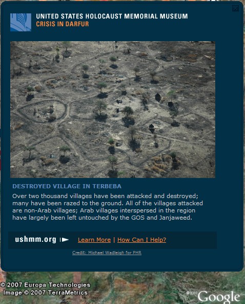
 Google's 3-D satellite image tool, Google Earth, has been recruited by the US Holocaust Memorial Museum (USHMM) to highlight the genocide in Darfur, as well as surrounding regions in Sudan and Chad. Using high resolution imagery, "Crisis in Darfur" offers users the ability to click on various photos showing the savage destruction committed by the janjaweed militias. The feature, the USHMM's first in its "Genocide Prevention Mapping Initiative", offers information beyond high-resolution mapping, such as graphs and testimonials, bringing advocacy to the desktops of millions of users. Google's Vice President, Elliot Schrage, said in a press conference yesterday; "What we've done is provide technology that enables organizations like the museum to leverage the power of the information they collect and accumulate to reach broad new audiences, to move those audiences, to engage them and, hopefully, energize them into action."
Roughly a quarter million people have been killed in the region since 2003. In January, 2005, The International Commission of Inquiry on Darfur report to the Secretary-General of the United Nations concluded that "the Government of the Sudan and the Janjaweed are responsible for serious violations of international human rights and humanitarian law amounting to crimes under international law". Among these allegations are the use of rape as a weapon and the dismemberment and killing of noncombatants. Though the Sudanese government denies the accusations, the USHMM hopes to highlight some of the more than 1600 damaged and destroyed villages, providing conclusive proof of the genocide.
Quote from Elliot Scharge from ABC News here.