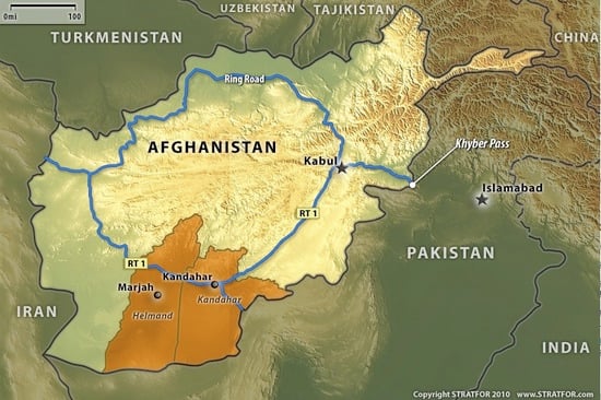
To really understand an international political issue or situation, knowledge of the local geography is necessary. A presentation I saw a few years back by an American marine who served in Afghanistan showcased that no modern technology, weapon, tactic, etc. could completely supplant the axiom that ‘Geography is destiny’. It is for this reason I will make a concerted effort to bring you more maps of Afghanistan’s geographic and political landscape. Today, here is a simple, but timely map from Stratfor showing Afghanistan’s Ring Road, Khyber Pass, and the two largely Taliban-controlled provinces of Helmand and Kandahar which have US/NATO targets assigned to them.

I would also like to highlight the story of fallen American soldier Nicholas Cook, who’s death has strongly affected the small Montana communities of Hungry Horse and Columbia Falls.